Navigation without GPS is no longer a research topic but a procurement line, driven by jamming and spoofing documented across Ukraine and the Middle East since 2022. The working solution stack layers inertial measurement over GPS: ring-laser and fiber-optic gyroscopes dead-reckon through jammed periods, aided by terrain matching, vision and signals of opportunity, while M-code receivers harden the GPS signal itself against hostile interference. Quantum inertial sensors, which measure acceleration using cold atoms, promise a step-change in drift performance but remain at laboratory and prototype stage, with DARPA and defense laboratories funding transition work.
The engineering question every program faces is drift budget: how accurately a platform must dead-reckon, and for how long, before a GPS fix returns.
How bad is GPS jamming in practice?
Widespread. Since 2022, navigation interference over conflict zones has become routine enough that aviation authorities issue standing notices, and open-source mapping of interference shows continuous jamming belts around active theaters. Effects run from lost position to spoofing, where a false signal walks a receiver to a location the operator does not choose. Commercial shipping and civil aviation in the eastern Mediterranean and the Black Sea region reported position errors through 2024 and 2025, per aviation authority advisories.
For military planners the conclusion is operational, not academic: assume GPS is unreliable over any contested area, at any altitude below the jamming ceiling, for the duration of a fight. That assumption is now written into requirements across munitions, aircraft and ground systems.
What does inertial navigation actually do?
An inertial navigation system integrates acceleration and rotation measured by gyroscopes and accelerometers to track position without any external signal. Modern military systems use ring-laser or fiber-optic gyros; accuracy is quoted as drift, the position error accumulated per hour of unaided flight. Airborne INS units of the current generation hold drift to fractions of a nautical mile per hour, and a missile-grade unit costs proportionally more for proportionally less drift.
The physics is unforgiving: error grows with time and with sensor bias, so the design problem is not eliminating drift but bounding it. Every practical solution pairs INS with periodic external updates, whether from GPS when available or from alternative aids when it is not. That pairing is why the jamming problem has generated a market for aiding sensors rather than a wholesale replacement for inertial units.
What are the aiding technologies filling GPS gaps?
Four families dominate. Terrain-referenced navigation matches a radar altimeter's ground profile against stored terrain data, a technique mature since cruise missiles of the 1980s. Vision-based navigation matches camera imagery against terrain and feature databases. Celestial navigation has returned on high-altitude platforms, with modern automated star trackers. Signals of opportunity exploit commercial transmissions, from cellular towers to broadcast signals, as ranging sources that a jammer targeting GPS does not touch.
Magnetic anomaly navigation and gravity gradiometry round out the research edge, attractive because the fields involved are effectively impossible to jam. Each aid trades against cost, weight and covertness: a radar altimeter is accurate but radiates, which matters for aircraft trying not to be seen.
What can quantum sensing actually deliver?
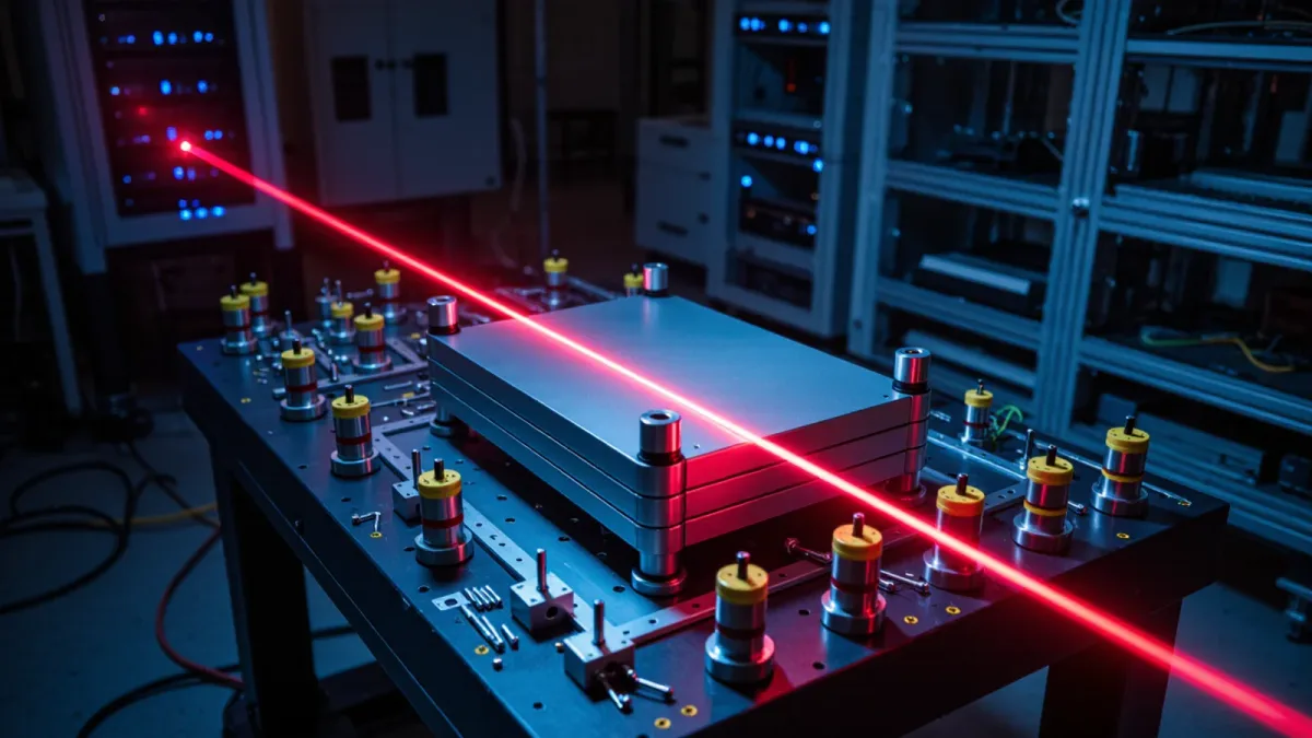
Quantum inertial sensors measure acceleration and rotation using atoms cooled to near absolute zero, exploiting matter-wave interference. Their theoretical advantage is stability: atoms of a known isotope provide an identical reference forever, in principle eliminating the bias drift that constrains conventional gyros and accelerometers. Defense research organizations, including DARPA and the Army Research Laboratory, have funded quantum inertial navigation since the mid-2010s, and laboratory demonstrations have shown navigation-grade performance over test trajectories.
The transition problem is environmental hardening and size, weight and power. Cold-atom systems historically needed vacuum systems, lasers and vibration isolation incompatible with a maneuvering fighter or a shell. Programs through 2025 focused on photonic integration and miniaturization precisely to close that gap, per DARPA program materials. The realistic near-term product is a quantum-aided INS that recalibrates a conventional unit in flight, not a standalone quantum navigator.
What does M-code change, and what does it not?
M-code is the military GPS signal, encrypted and spectrally separated from civil signals to resist jamming and spoofing. The first GPS III satellite launched in December 2018, and the military receiver modernization that fielded M-code capability ran through the early 2020s. M-code raises the bar for an adversary: jamming an encrypted, higher-power signal demands more transmit power and more sophisticated systems than overwhelming a civil signal.
What it does not change is the physics of radio navigation. M-code still requires line of sight to satellites and still arrives at a power level a determined jammer can contest locally. It hardens the GPS layer; it does not remove the need for inertial and alternative aids beneath it. Procurement that treats M-code receivers as the answer to GPS denial has misread the threat model.
How should buyers frame the requirement?
Frame it as an assured navigation budget: specify the accuracy and time window the platform must survive without GPS, then buy the cheapest stack that meets it. A loitering munition needs one grade; a submarine another; a long-range missile another. The market now offers that range, from $1,000-class tactical IMUs aided by vision to navigation-grade INS with celestial and quantum augmentation in development. Platforms designed today should also carry the interfaces for future quantum aids, because the sensors arriving at the end of the decade will want a home in the navigation solution.
What does GPS denial change for operators on the ground?
For dismounted units and vehicle crews, the effect is training as much as hardware. Map reading, compass work and pre-planned rally procedures that atrophied during two decades of GPS-constant operations returned to training calendars after 2022, per service training commands. Platform crews practice navigating on inertial and visual references under jammed conditions, and commanders plan timing on the assumption that position data degrades during any engagement. Equipment follows the same logic: multimode receivers that fall back between signals, vehicle INS units that hold accurate dead-reckoning to a rally point, and munitions with terminal seekers that no longer assume a GPS-quality fix at launch. Vendors who package aids for the dismounted user, not just platforms, are addressing the largest population in the force.
Frequently Asked Questions
What happens to a missile when GPS is jammed?
It falls back on its inertial navigation system, which dead-reckons from launch, accumulating drift the longer it flies without an update. Accuracy depends on the unit's drift rate and flight time: a short-range weapon may hold acceptable accuracy through a jammed terminal phase, while a long flyer without aiding sensors drifts materially. This is why aiding sensors and harder signals, not just better IMUs, define the counter-jamming response.
What is M-code GPS?
M-code is the encrypted military GPS signal, spectrally separated from civil signals and designed to resist jamming and spoofing. The first GPS III satellite carrying it launched in December 2018, and military receiver modernization ran through the early 2020s. It hardens satellite navigation against interference but still requires line of sight to the constellation, so it complements rather than replaces inertial navigation.
Are quantum navigation sensors fielded today?
No. Quantum inertial sensors remain at laboratory and prototype stage through 2025, with DARPA and service laboratories funding miniaturization and environmental hardening. Laboratory demonstrations have shown the promised drift advantages, and near-term transition targets are hybrid systems where a quantum sensor recalibrates a conventional INS, not standalone quantum navigators in operational platforms.
What is inertial navigation drift?
Drift is the position error an inertial system accumulates per hour without an external fix, caused by tiny biases in gyroscopes and accelerometers. Military airborne units hold drift to fractions of a nautical mile per hour; lower grades accumulate error faster. Every operational navigation architecture bounds drift by pairing INS with periodic updates from GPS or alternative aids.